Webmaster Notes
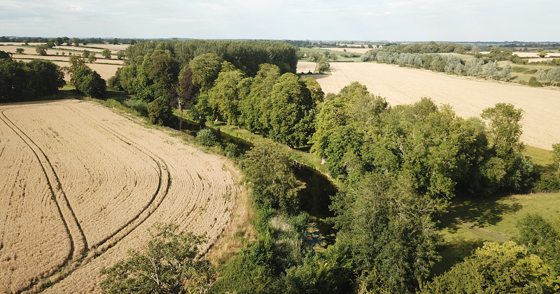
The stretch of water next to the church in Belchamp Walter.
A swathe of grass bordered by a line of trees on the bank of a long pond. Footpath from Hall Cottage to The Munt Farm.
You can make a circular walk around the church past Munt House and the Munt Farm entrance to Belchamp Hall (holiday-lets - AirBNB) past the church, down the hill keeping to the left and then along by the pond and returning on a footpath that is beside the farmyard and factory units.
Monks Pond - Belchamp Walter - a.k.a. The Long Pond
Monks Pond in Belchamp Walter is also known as "the Canal".
The archaeologydataservice website say that the earthworks are situated to the East of St.Mary's Church Belchamp Walter.
I would say that it is more like between East by North and East North East of the Church.
Top
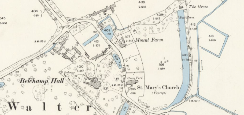
The 1897 OS map shows the earthworks as part of the drainage system
The Description (on the archaeologydataservice website):
"
Ditched enclosure of unknown date situated on low lying water meadows incorporated into the field drainage system.
There is no indication that it has been used as a homestead.
"
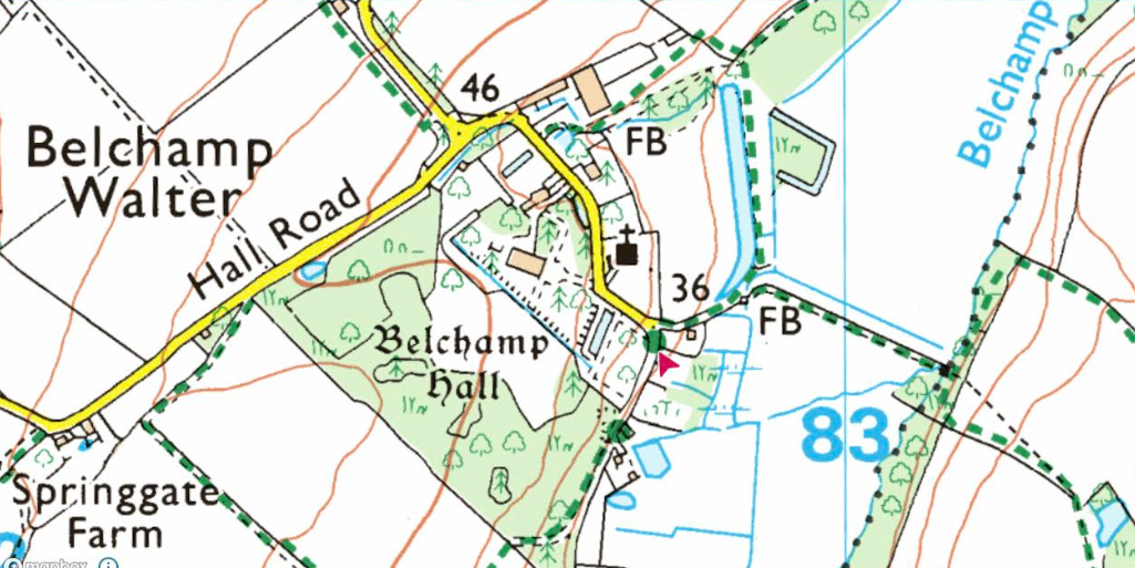
On the current OS Explorer map the earthworths are shown as a "U-shaped" feature.
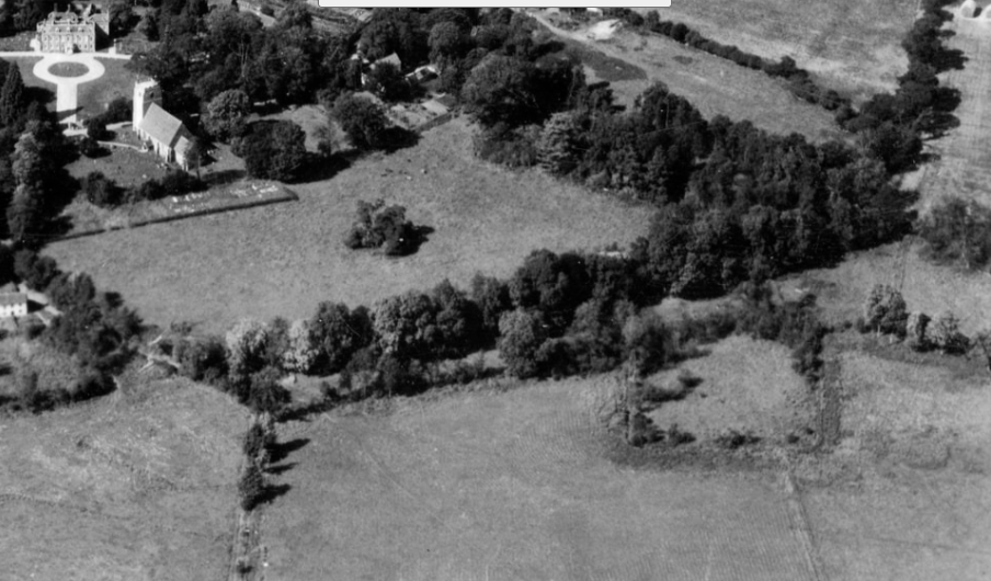
The WW2 aerial photograph from 1948 shows the earthworks in relation to the Church.
The pond and the earthworks were also the site of a Italian WW2 prisoner of war camp. The oak trees on the East bank of
the pond have graffiti carvings in Italian.
Historic England Research Records
"
Moat, probably around a cattle enclosure, 250 yards east north east of Belchamp Walter Church. (2)
A water filled ditched enclosure situated on low lying water
meadows and incorporated into the field drainage system. It
measures overall 70.0m north east to south-west by 90.0m
transversely, with arms about 5.0m wide. The enclosure is
apparently undisturbed and no indication that it had been used as
a homestead, and was probably used as a cattle enclosure. The
Tithe map shows no buildings within the area which has the field
name of 'Hoppet'. (a) (3)
"
References:
1 Ordnance Survey Map: OS 6" 1967
2 An inventory of the historical monuments in Essex. Volume I [north west] p 20
3 Field Investigators Comments: F1 PAS 27-AUG-76
3a Externally held archive reference: Tithe Map 1840
Monument type: Medieval
Date: 1540 1066
Ditched Enclosure
Evidence: Earthwork
Monument Period Name: Uncertain
Referral
Visits on 18 December 2022.
It is presumed that these were from Social Media.
The .ac Domain
The Archaeology Data Service, ADS (archaeologydataservice.ac.uk) has a .ac domain.
This is an "academic" designation for a website????
Some drone photographs
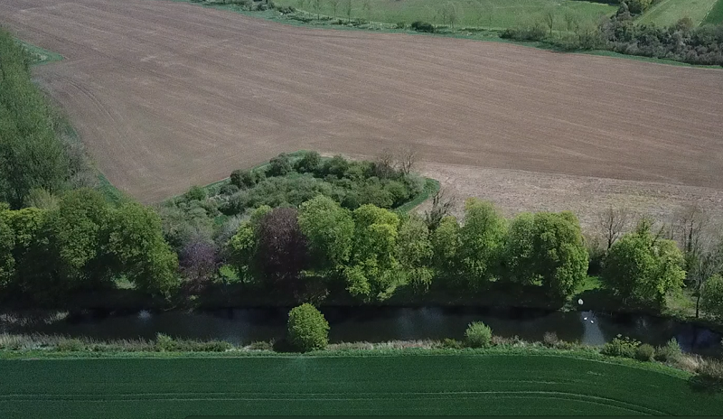
This is a view of the earthworks in 2020 looking East. The earthworks appear to be completely "grown-in" and
the fact that it may have been a cattle enclosure is not obvious.
Below is a photo of the pond to show it in perpective with respect to its shape and position on the OS map.
